
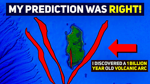
My Prediction About King Island Was Right!
#tasmania #victoria #kingisland #volcanology #australia #geology #earthscience #earthsciences #geography #oceanic #ocean #volcanicarc #bassstrait #volcanoes #volcanoeruption #geoscience #ocean #supervolcano #magnetics
Join us on a fascinating geological exploration as we unearth an ancient volcanic arc hidden in the ocean near Tasmania and the associated mineralization. In this episode I follow up on my claim that gold would be found here as a result of my intensive studying of the geology and geophysical features of the King Island.
In the last episode, we used magnetics to reveal the islands' secrets between Tasmania and Victoria, shedding light on Australia's underexplored geological wonders. We journeyed back to the birth of the Microcontinent VanDieLand, explored the complex geological history of King Island, and formulated hypotheses about recent rift zones. This exploration underscored the immense tectonic and volcanic forces that have shaped our planet and the potential for new discoveries in underexplored lands.
The link to Episode 1 can be found here:
https://www.youtube.com/watch?v=SCZ_Z4NnikA
A recent compilation of a few videos that discussed the events surrounding the rift zone in Melbourne along with other very relevant topics as it pertains to this video:
https://www.youtube.com/watch?v=HOlJnpBkyBg
Don't forget to like, share, and subscribe for more deep-dive content into the wonders of our planet!
I hope you enjoyed this video. If you wish to be in the loop for more content such as this, each like, share, comment and subscription helps the channel out immensely.
If you are not in a position to donate, I totally understand! The biggest supporting factor that you engage in is to watch our videos all the way to the end (very important for helping us rank) and to share them around so please consider doing this so that Youtube recommends our channel more.
If you are in a position to support our channel on Youtube Membership or by donating to our PayPal, the link to all of this can be found below:
If you are not in a position to donate, I totally understand! The biggest supporting factor you engage in is watching our videos all the way to the end (very important for helping us rank) and sharing them around so please consider doing this so that Youtube recommends our channel more.
💗 Link To The OzGeographics Website:
https://www.ozgeographics.com
💟 Link to our PayPal:
paypal.me/OzGeographicsYoutube
For one time donations to show your support for this channel and to allow me to focus on this channel.
🌋 Subscribe to our Youtube Channel: https://www.youtube.com/channel/UCxLrvjGBzYmj8W1rJToPasgsub_confirmation=1
🌏 About OzGeographics
OzGeographics, formally known as Geographics, is an Australian based Youtube channel that releases high quality documentaries in an easy to digest format. We primarily release videos that cover topics in the realm of Earth Sciences or natural disasters, but we also release the odd video here or there that delves into other sciences, or other topics altogether depending on how compelling we find the topic at hand.
Our videos are catered for anyone and everyone, and our goal is to attempt to explain hard to understand events in an easy to digest manner that isn't too "dry" in its presentation.
1.1K
views
2
comments
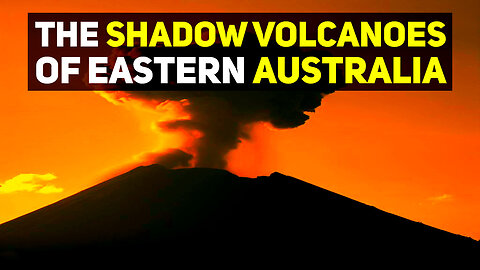
Unveiling Australia's Shadow Volcanoes: The Hidden Geological Phenomenon
#shadowvolcanoes #tasmania #victoria #kingisland #newsouthwales #queensland #cosgrovehotspot #basalt #volcanology #australia #geology #earthscience #earthsciences #geography #oceanic #ocean #volcanicarc #bassstrait #volcanoes #volcanoeruption #geoscience #ocean #supervolcano #magnetics
Discover the fascinating geological phenomenon of 'Shadow Volcanoes' - the hidden remnants of volcanic activity across Eastern Australia. This video dives deep into the history of volcanic activity in the region, which started around 95 million years ago with the rifting of Australia and New Zealand and led to a sequence of eruptions that marked the landscape over millions of years.
However, these basaltic structures, less resistant to erosion than their silica-rich counterparts, have often been worn away, leaving only subtle traces detectable through Earth's magnetic fields. These are the 'Shadow Volcanoes,' unseen but undeniably influential in shaping the landscape. We explore the significance of these geological structures, especially for exploration and mining, shedding light on their impacts and calling for a more comprehensive recognition in official geological maps. Journey with us into the past to uncover these hidden gems of Earth's volatile history.
Don't forget to like, share, and subscribe for more deep-dive content into the wonders of our planet!
I hope you enjoyed this video. If you wish to be in the loop for more content such as this, each like, share, comment and subscription helps the channel out immensely.
If you are not in a position to donate, I totally understand! The biggest supporting factor that you engage in is to watch our videos all the way to the end (very important for helping us rank) and to share them around so please consider doing this so that Youtube recommends our channel more.
If you are in a position to support our channel on Youtube Membership or by donating to our PayPal, the link to all of this can be found below:
If you are not in a position to donate, I totally understand! The biggest supporting factor you engage in is watching our videos all the way to the end (very important for helping us rank) and sharing them around so please consider doing this so that Youtube recommends our channel more.
💗 Link To The OzGeographics Website Article:
https://ozgeographics.com/blogs/news/...
💟 Link to our PayPal:
paypal.me/OzGeographicsYoutube
For one time donations to show your support for this channel and to allow me to focus on this channel.
🌋 Subscribe to our Youtube Channel: https://www.youtube.com/channel/UCxLr...
🌏 About OzGeographics
OzGeographics, formally known as Geographics, is an Australian based Youtube channel that releases high quality documentaries in an easy to digest format. We primarily release videos that cover topics in the realm of Earth Sciences or natural disasters, but we also release the odd video here or there that delves into other sciences, or other topics altogether depending on how compelling we find the topic at hand.
Our videos are catered for anyone and everyone, and our goal is to attempt to explain hard to understand events in an easy to digest manner that isn't too "dry" in its presentation.
1.86K
views
13
comments
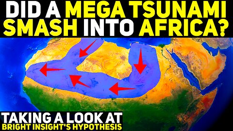
Did A Mega Tsunami Smash Into The Sahara?
Several Youtubers have recently began to put out a hypothesis regarding a possible mega tsunami event that they speculate swept through the Saharan desert. Among these, is the prominent Youtuber, Jimmy Corsetti. I've watched Jimmy's channel for years, and, have also been a fan of Randall Carlson for the same period of time. I've spent many hours of my life nerding out on both channels, and they are responsible, in part, for the path I am walking today. I've always been fascinated by earth shattering mega disasters. And that's actually what originally led to my foray and journey into Geology.
In this episode, I take a deep look into the points of evidence brought forth by Mr. Corsetti, regarding the striations and landforms located in the Saharan desert, which he asserts are related to a mega tsunami event. Randall Carlson, has added his input, and has speculated that the visual features seen in the Sahara, are, from his point of view, fluvial related, meaning, a rainstorm or deluge event, possibly lasting days or weeks occurred here in his opinion.
This is episode 1 of this series, and in this episode, we will begin by taking a look at the claims asserted, and whether or not they hold weight (in my opinion).
I hope you enjoyed this video. If you wish to be in the loop for more content such as this, each like, share, comment and subscription helps the channel out immensely.
If you are not in a position to donate, I totally understand! The biggest supporting factor that you engage in is to watch our videos all the way to the end (very important for helping us rank) and to share them around so please consider doing this so that Youtube recommends our channel more.
If you are in a position to support our channel by donating to our PayPal, or our gofundme, the link to all of this can be found below:
Link to episodes in the Burckle Crater Mega Tsunami Series:
Episode 1: https://www.youtube.com/watch?v=V_H6W2R88Z0
Episode 2: https://www.youtube.com/watch?v=syCWb_ySJRo
Episode 3: https://www.youtube.com/watch?v=DBBCKghodVI
Episode 4: https://www.youtube.com/watch?v=tasGHdFXa0s
Episode 5: https://www.youtube.com/watch?v=7w6HrPujyJQ
Episode 6: https://www.youtube.com/watch?v=_GzJfnWllGE
Episode 7: https://www.youtube.com/watch?v=Fri-lXx01x4
Global Deluge:
Episode 8: https://www.youtube.com/watch?v=CGFPOp61t3A
Episode 9: https://www.youtube.com/watch?v=3LeOues4Kp4
💗 Gofundme
https://www.gofundme.com/f/zkt74-help-ozgeographics-to-fulfill-his-dream
💟 Link to our PayPal:
paypal.me/OzGeographicsYoutube
For one time donations to show your support for this channel and to allow me to focus on this channel.
🌋 Subscribe to our Youtube Channel: https://www.youtube.com/channel/UCxLrvjGBzYmj8W1rJToPasgsub_confirmation=1
🌏 About OzGeographics
OzGeographics, formally known as Geographics, is an Australian based Youtube channel that releases high quality documentaries in an easy to digest format. We primarily release videos that cover topics in the realm of Earth Sciences or natural disasters, but we also release the odd video here or there that delves into other sciences, or other topics altogether depending on how compelling we find the topic at hand.
Our videos are catered for anyone and everyone, and our goal is to attempt to explain hard to understand events in an easy to digest manner that isn't too "dry" in its presentation.
962
views
2
comments
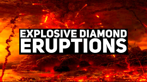
The Volcano That Erupts Diamonds
Diamonds are associated with a very strange and rare type of volcanic eruption. Volcanic pipes, aren't all that uncommon. What is, though, is the variant of them, which sources magma from close to 700km deep within the Earth. What this means, is this magma, passes through a transition zone known as the Diamond stability field. And as a result of this, it's able to bring diamonds up to the surface when it erupts.
But it's not only this that makes Kimberlite so strange. It's also the fact that the type of magma that kimberlite is comprised of, is known as ultra-mafic. Mafic magma, is known for being relatively non-explosive and more effusive in the way it erupts. This is because of the very low silica levels that Mafic magma inhabits. As you can probably imagine, ultra-mafic magma contains even less silica. Yet, it's able to explode up from depths of over 600 kilometers and surface in a matter of hours.
Kimberlite eruptions also have no magma chamber. They literally just push their way to the surface, at a tremendous speed, propelled forth by a strange chemistry from deep within the Earth, only to surface is an extremely explosive manner. Thankfully, these eruptions aren't anything close to what one would witness with a supervolcanic eruption. They don't affect the entire Earth, but if one happened near you... trust me, you'd know about it.
I hope you enjoyed this video. If you wish to be in the loop for more content such as this, each like, share, comment and subscription helps the channel out immensely.
If you are not in a position to donate, I totally understand! The biggest supporting factor that you engage in is to watch our videos all the way to the end (very important for helping us rank) and to share them around so please consider doing this so that Youtube recommends our channel more.
If you are in a position to support our channel by donating to our PayPal or our gofundme, the link to all of this can be found below:
💗 Support our GoFundMe:
https://gofund.me/106b528c
💟 Link to our PayPal:
paypal.me/OzGeographicsYoutube
For one time donations to show your support for this channel and to allow me to focus on this channel.
803
views
3
comments
New South Wales' Massive Tweed Volcano
Tweed Volcano is a heavily eroded shield volcano, that existed in its live state around 23 million years ago. This incredible landmark is the largest volcano in Australia, and, the massive erosion caldera that exists in Tweed, is the largest in the southern hemisphere.
Tweed has a very interesting history. Because even though it's a shield volcano, it's also released some extremely explosive volcanic eruptions. The felsic version of Tweed, is due to the melting of the ancient Triassic-Permian volcanic bedrock that existed here prior to Australia passing over a magmatic plume, known as the Cosgrove hotspot.
The vast amounts of basalt and trachyte released by this plume, travelled up through weaknesses in the lower crust of Australia, melting continental felsic rocks along the way, and altering the chemistry of the basalt, from a low silica composition, to one that was dominated by silica.
So this is the story of what is, by far, the most impressive volcano to currently exist in Australia.
I hope you enjoyed this video. If you wish to be in the loop for more content such as this, each like, share, comment and subscription helps the channel out immensely.
If you are not in a position to donate, I totally understand! The biggest supporting factor that you engage in is to watch our videos all the way to the end (very important for helping us rank) and to share them around so please consider doing this so that Youtube recommends our channel more.
If you are in a position to support our channel on Youtube Membership, Patreon, or by donating to our PayPal, the link to all of this can be found below:
Link to Queensland's Glass House Mountains Video:
https://www.youtube.com/watch?v=3avWNHoEDAg
💗 SUPPORT OUR PATREON
https://www.patreon.com/OzGeographics
Become a Patreon to unlock special perks, benefits, and the link to our discord server.
🎥 Join our Youtube Channel!
https://www.youtube.com/channel/UCxLrvjGBzYmj8W1rJToPasg/join
Become a Member to access special perks, benefits, our discord server and badges!
💟 Link to our PayPal:
paypal.me/OzGeographicsYoutube
For one time donations to show your support for this channel and to allow me to focus on this channel.
🌋 Subscribe to our Youtube Channel: https://www.youtube.com/channel/UCxLrvjGBzYmj8W1rJToPasgsub_confirmation=1
🌏 About OzGeographics
OzGeographics, formally known as Geographics, is an Australian based Youtube channel that releases high quality documentaries in an easy to digest format. We primarily release videos that cover topics in the realm of Earth Sciences or natural disasters, but we also release the odd video here or there that delves into other sciences, or other topics altogether depending on how compelling we find the topic at hand.
Our videos are catered for anyone and everyone, and our goal is to attempt to explain hard to understand events in an easy to digest manner that isn't too "dry" in its presentation.
We strive to explain hard to understand scientific phenomenon in a way that isn't too boring, or hard to understand, so that people from all backgrounds can understand, learn, and appreciate this content and what we are discussing to a greater extent.
We release videos once per week at a minimum and we regularly engage with our community to keep them updated on all things OzGeographics!
#tweed #tweedvolcano #mountwarning #newsouthwales #nsw #geology #geological #geologicalhistory #volcanology #volcanoes #volcaniceruption #volcaniceruptions #earthscience #earthsciences #geoscience #geosciences #geography #felsic #mafic #basalt #explosive #effusive #tweedvolcaniceruption
1.17K
views
3
comments
Why Australia Has Active Volcanoes When It Is Tectonically Stable
Australia has many volcanoes that have erupted very recently. With the last eruption occurring only 5000 years ago. As many people know, Australia is tectonically stable. So, in theory, many people wouldn't expect pronounced earthquakes or volcanoes to occur here. And yet, they have, en masse, for around 31 million years. Starting in Northern queensland, and slowly working their way south over time, reaching Victoria 7 million years ago, where it transformed the land completely. Burying the ancient landscape that once existed here beneath wave after wave of lava flow.
This is the story of Australia's volcanism and is a great example of intraplate volcanism.
I hope you enjoyed this video. If you wish to be in the loop for more content such as this, each like, share, comment and subscription helps the channel out immensely.
If you are not in a position to donate, I totally understand! The biggest supporting factor that you engage in is to watch our videos all the way to the end (very important for helping us rank) and to share them around so please consider doing this so that Youtube recommends our channel more.
If you are in a position to support our channel on Youtube Membership, Patreon, or by donating to our PayPal, the link to all of this can be found below:
💗 Link to our gofundme:
https://www.gofundme.com/f/zkt74-help-ozgeographics-to-fulfill-his-dream
💟 Link to our PayPal:
paypal.me/OzGeographicsYoutube
For one time donations to show your support for this channel and to allow me to focus on this channel.
🌋 Subscribe to our Youtube Channel: https://www.youtube.com/channel/UCxLrvjGBzYmj8W1rJToPasgsub_confirmation=1
🌏 About OzGeographics
OzGeographics, formally known as Geographics, is an Australian based Youtube channel that releases high quality documentaries in an easy to digest format. We primarily release videos that cover topics in the realm of Earth Sciences or natural disasters, but we also release the odd video here or there that delves into other sciences, or other topics altogether depending on how compelling we find the topic at hand.
Our videos are catered for anyone and everyone, and our goal is to attempt to explain hard to understand events in an easy to digest manner that isn't too "dry" in its presentation.
We strive to explain hard to understand scientific phenomenon in a way that isn't too boring, or hard to understand, so that people from all backgrounds can understand, learn, and appreciate this content and what we are discussing to a greater extent.
We release videos once per week at a minimum and we regularly engage with our community to keep them updated on all things OzGeographics!
#australia #volcanoes #volcaniceruptions #sydney #nsw #victoria #queensland #brisbane #cairnes #melbourne #creswick #ballarat #daylesford #geology #geography #geological #geologicalhistory #earthscience #earthsciences #volcanology
1.48K
views
15
comments
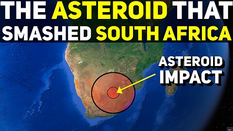
The Largest Asteroid Impact On Earth That Smashed Into South Africa
#southafrica #africa #geology #asteroid #asteroidimpact #crater #impactcrater #vredefortimpactcrater #vredefort #vredefortimpactevent#geoscience #disaster #earthscience #volcanoes #extinction #extinctionevent #comet #meteorite #bolide #asteroids
The Vredefort Crater is, to this day, the largest known proven impact site on our planet. A massive asteroid smashed into here a little over 2 billion years ago, and, the land has never been the same since.
Join us, as we head into South Africa, to witness one of the most destructive and chaotic events to have ever impacted the planet.
I hope you enjoyed this video. If you wish to be in the loop for more content such as this, each like, share, comment and subscription helps the channel out immensely.
If you are not in a position to donate, I totally understand! The biggest supporting factor that you engage in is to watch our videos all the way to the end (very important for helping us rank) and to share them around so please consider doing this so that Youtube recommends our channel more.
If you are in a position to support our channel on Youtube Membership, Patreon, or by donating to our PayPal, the link to all of this can be found below:
If you are not in a position to donate, I totally understand! The biggest supporting factor that you engage in is to watch our videos all the way to the end (very important for helping us rank) and to share them around so please consider doing this so that Youtube recommends our channel more.
If you are in a position to support our channel by donating to our PayPal, or to our Gofundme, the link to all of this can be found below:
Western Australia Impact Event - Woodleigh Crater:
https://www.youtube.com/watch?v=Nmzt2yHnLEI
Lake Acraman Impact Event:
https://www.youtube.com/watch?v=YYhUiHGpezk
💗 Gofundme
https://www.gofundme.com/f/zkt74-help-ozgeographics-to-fulfill-his-dream
💟 Link to our PayPal:
paypal.me/OzGeographicsYoutube
For one time donations to show your support for this channel and to allow me to focus on this channel.
🌋 Subscribe to our Youtube Channel: https://www.youtube.com/channel/UCxLrvjGBzYmj8W1rJToPasgsub_confirmation=1
🌏 About OzGeographics
OzGeographics, formally known as Geographics, is an Australian based Youtube channel that releases high quality documentaries in an easy to digest format. We primarily release videos that cover topics in the realm of Earth Sciences or natural disasters, but we also release the odd video here or there that delves into other sciences, or other topics altogether depending on how compelling we find the topic at hand.
Our videos are catered for anyone and everyone, and our goal is to attempt to explain hard to understand events in an easy to digest manner that isn't too "dry" in its presentation.
176
views
2
comments
A Beautiful Crossover of Volcanics That Tell A Fascinating Story
#australia #volcanoes #volcaniceruptions #victoria #ballarat #gongong #granite #intrusive #igneous #granodiorite #quartzmonzonite #goldfields #melbourne #creswick #ballarat #daylesford #geology #geography #geological #geologicalhistory #earthscience #earthsciences #volcanology #cosgrovehotspot #hotspot #volcanism #volcanic #volcaniceruption #mafic #intermediate #felsic
Australia has many volcanoes that have erupted very recently. With the last eruption occurring only 5000 years ago. But 360 million years, Victoria was a totally different place. It was chaotic and rife with volcanism and earthquakes. These were the early days of eastern Australia, when it was still being built, fragment by fragment, like a jigsaw puzzle. And during these times, supervolcanoes, and typical composite volcanoes, dominated the land, roaring forth with tremendous vigor.
In this video, we take a look at a fascinating story these events left behind in rock form, for us to interpret in present day.
I hope you enjoyed this video. If you wish to be in the loop for more content such as this, each like, share, comment and subscription helps the channel out immensely.
If you are not in a position to donate, I totally understand! The biggest supporting factor that you engage in is to watch our videos all the way to the end (very important for helping us rank) and to share them around so please consider doing this so that Youtube recommends our channel more.
If you are in a position to support our channel on Youtube Membership, Patreon, or by donating to our PayPal, the link to all of this can be found below:
💗 Link to our gofundme:
https://www.gofundme.com/f/zkt74-help-ozgeographics-to-fulfill-his-dream
💟 Link to our PayPal:
paypal.me/OzGeographicsYoutube
For one time donations to show your support for this channel and to allow me to focus on this channel.
Why Australia Has Active Volcanoes When It Is Tectonically Stable
https://www.youtube.com/watch?v=ihcJDunRhcY
🌋 Subscribe to our Youtube Channel: https://www.youtube.com/channel/UCxLrvjGBzYmj8W1rJToPasgsub_confirmation=1
🌏 About OzGeographics
OzGeographics, formally known as Geographics, is an Australian based Youtube channel that releases high quality documentaries in an easy to digest format. We primarily release videos that cover topics in the realm of Earth Sciences or natural disasters, but we also release the odd video here or there that delves into other sciences, or other topics altogether depending on how compelling we find the topic at hand.
Our videos are catered for anyone and everyone, and our goal is to attempt to explain hard to understand events in an easy to digest manner that isn't too "dry" in its presentation.
We strive to explain hard to understand scientific phenomenon in a way that isn't too boring, or hard to understand, so that people from all backgrounds can understand, learn, and appreciate this content and what we are discussing to a greater extent.
We release videos once per week at a minimum and we regularly engage with our community to keep them updated on all things OzGeographics!
73
views
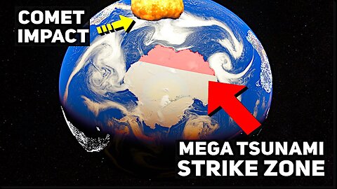
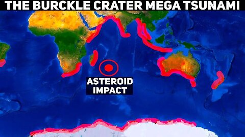
Mega Tsunami Evidence Discovered in Antarctica for The First Time
I have found what I consider to be extremely strong evidence regarding the existence of chevrons in Antarctica. These chevrons occur en masse, in the direct firing line that a mega tsunami would travel, post-burckle crater impact. When the comet that created the Burckle Crater struck a deep section of the indian ocean, the mega tsunami that it created travelled outwards from the epicenter in a 360 degree direction, hitting every single shoreline of every continent that was near. Antarctica was no exception to this, but, I originally thought any evidence of this event would either be buried, or long gone. I was wrong.
Today we'll look at the compelling evidence I found on the shorelines of Antarctica. The very same 200 odd meter high mega tsunami wave that hit Australia, also hit here, and after spending so many days using this simulator to read Australia, Indonesia's, and the rest of the impacted worlds' tsunami evidence, I spotted these shapes with ease. These shapes both begin, and end, inline with the Burckle Crater impact. With the damage and chevron deposition ceasing right at the point that is outside the line of travel from the epicenter that this Tsunami would've travelled.
I believe this is the first time evidence of this event has been linked to Antarctica. If not, I stand corrected, but if so, that's pretty amazing. You certainly wouldn't be able to make these features out with confidence on neither Google maps, or Google Earth. But this simulator shines yet again, when detecting the chevrons, purely because of it's incredible topographical accuracy and succinct attention to detail.
Link to Part 1 of this series:
https://www.youtube.com/watch?v=V_H6W2R88Z0
Link to Part 2 of this series:
https://www.youtube.com/watch?v=syCWb_ySJRo
Link to Part 3 of this series:
https://www.youtube.com/watch?v=DBBCKghodVI
Link to Full Length Documentary:
https://www.youtube.com/watch?v=eINb338Ewuo
If you are not in a position to donate, I totally understand! The biggest supporting factor that you engage in is to watch our videos all the way to the end (very important for helping us rank) and to share them around so please consider doing this so that Youtube recommends our channel more.
If you are in a position to support our channel on Youtube Membership, Patreon, or by donating to our PayPal, the link to all of this can be found below:
Link to studies:
https://academiccommons.columbia.edu/doi/10.7916/D89P31F3
https://ui.adsabs.harvard.edu/abs/2010avh..confE..13A/abstract
💗 SUPPORT OUR PATREON
https://www.patreon.com/OzGeographics
Become a Patreon to unlock special perks, benefits, and the link to our discord server.
🎥 Join our Youtube Channel!
https://www.youtube.com/channel/UCxLrvjGBzYmj8W1rJToPasg/join
Become a Member to access special perks, benefits, our discord server and badges!
💟 Link to our PayPal:
paypal.me/OzGeographicsYoutube
For one time donations to show your support for this channel and to allow me to focus on this channel.
🌋 Subscribe to our Youtube Channel: https://www.youtube.com/channel/UCxLrvjGBzYmj8W1rJToPasgsub_confirmation=1
🌏 About OzGeographics
OzGeographics, formally known as Geographics, is an Australian based Youtube channel that releases high quality documentaries in an easy to digest format. We primarily release videos that cover topics in the realm of Earth Sciences or natural disasters, but we also release the odd video here or there that delves into other sciences, or other topics altogether depending on how compelling we find the topic at hand.
Our videos are catered for anyone and everyone, and our goal is to attempt to explain hard to understand events in an easy to digest manner that isn't too "dry" in its presentation.
1.24K
views
3
comments
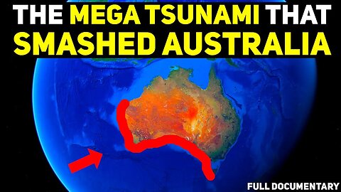
The Comet Impact & Mega Tsunami That Drowned Australia - Full Documentary
#megatsunami #kangarooisland #tsunami #tidalwave #hugewaves #flooding #comet #impact #event #burcklecrater #crater #australia #perth #victoria #tasmania #kingisland #threehummockisland #westernaustralia #hobart #victoria #melbourne #southaustralia #adelaide #geoscience #geology #naturaldisaster #naturaldisasters #meteorite #asteroid #asteroidhittingearth #meteoritecrater #meteorites #earthscience #geological #earthsciences #geosciences #australia #geography #geological #geologicalhistory
5000 years ago, a comet broke apart into three pieces upon entry into Earth. The largest piece, smashed into the indian ocean, with the other two smaller pieces landing in different areas of the Pacific Ocean. The Indian Ocean impact, was incredibly disastrous. It landed in a very deep part of the ocean, and, as a result, it released a truly monstrous mega tsunami during impact. This tsunami was so disastrous, that 600 foot high mountains were built in Madagascar in the blink of an eye, when massive amount of churned up sediment that was carried by it, got deposited in truly vast quantities here, and everywhere else that this tsunami stuck, too, including very, very far places, such as Tasmania.
When this Mega tsunami struck, it did so with such force, that it severely eroded entire cliff faces, and left deep gashing scars in the land, which document the direction of the flow. Along with this, it also deposited something known as seismic chevrons. Which are arrow shaped hills of deposition, that were left after the wave had slammed into Australia. When it began to recede, all the material it carried was just dropped where it landed, and the water move out, but the sediment remained. Because of this, massive layers of sand were deposited, and even though 5000 years have passed, you can still see many places where this tsunami impacted.
In this full length documentary, the 3 episodes that cover this topic were combined and as a result we start in Perth, before moving onto Tasmania, Victoria, then we head west to South Australia, before ending our journey in the far northern tip of Western Australia. We go through bit by bit, documenting the evidence of this event, and as we hit South Australia, the evidence really begins to ramp up. I teach you how to identify chevrons, what they are and how they form, and I also cover the difference between chevrons and aeolian processes, including what the intertwining of these two looks like.
I hope you enjoyed this video. If you wish to be in the loop for more content such as this, each like, share, comment and subscription helps the channel out immensely.
Link to Part 1 of this series:
https://www.youtube.com/watch?v=V_H6W2R88Z0
Link to Part 2 of this series:
https://www.youtube.com/watch?v=syCWb_ySJRo
Link to Part 3 of this series:
https://www.youtube.com/watch?v=DBBCKghodVI
If you are not in a position to donate, I totally understand! The biggest supporting factor that you engage in is to watch our videos all the way to the end (very important for helping us rank) and to share them around so please consider doing this so that Youtube recommends our channel more.
If you are in a position to support our channel on Youtube Membership, Patreon, or by donating to our PayPal, the link to all of this can be found below:
Link to studies:
https://academiccommons.columbia.edu/doi/10.7916/D89P31F3
https://ui.adsabs.harvard.edu/abs/2010avh..confE..13A/abstract
💗 SUPPORT OUR PATREON
https://www.patreon.com/OzGeographics
Become a Patreon to unlock special perks, benefits, and the link to our discord server.
🎥 Join our Youtube Channel!
https://www.youtube.com/channel/UCxLrvjGBzYmj8W1rJToPasg/join
Become a Member to access special perks, benefits, our discord server and badges!
💟 Link to our PayPal:
paypal.me/OzGeographicsYoutube
For one time donations to show your support for this channel and to allow me to focus on this channel.
🌋 Subscribe to our Youtube Channel: https://www.youtube.com/channel/UCxLrvjGBzYmj8W1rJToPasgsub_confirmation=1
🌏 About OzGeographics
OzGeographics, formally known as Geographics, is an Australian based Youtube channel that releases high quality documentaries in an easy to digest format. We primarily release videos that cover topics in the realm of Earth Sciences or natural disasters, but we also release the odd video here or there that delves into other sciences, or other topics altogether depending on how compelling we find the topic at hand.
Our videos are catered for anyone and everyone, and our goal is to attempt to explain hard to understand events in an easy to digest manner that isn't too "dry" in its presentation.
199
views

The Mega Tsunami That Smashed Australia's Southern & Western Shorelines
5000 years ago, a comet broke apart into three pieces upon entry into Earth. The largest piece, smashed into the indian ocean, with the other two smaller pieces landing in different areas of the Pacific Ocean. The Indian Ocean impact, was incredibly disastrous. It landed in a very deep part of the ocean, and, as a result, it released a truly monstrous mega tsunami during impact. This tsunami was so disastrous, that 600 foot high mountains were built in Madagascar in the blink of an eye, when massive amount of churned up sediment that was carried by it, got deposited in truly vast quantities here, and everywhere else that this tsunami stuck, too, including very, very far places, such as Tasmania.
When this Mega tsunami struck, it did so with such force, that it severely eroded entire cliff faces, and left deep gashing scars in the land, which document the direction the flow. Along with this, it also deposited something known as seismic chevrons. Which are arrow shaped hills of deposition, that were left after the wave had slammed into Australia. When it began to recede, all the material it carried was just dropped where it landed, and the water move out, but the sediment remained. Because of this, massive layers of sand were deposited, and even though 5000 years have passed, you can still see many places where this tsunami impacted.
The entire western coast of Western Australia, and the southern coast of it, had towns that are built ontop of the sediment released by the mega tsunami, as this entire section of land was deeply affected by the 180 odd meter waves that struck here with savage force. Stretching inland as far as 30km in some places, and even further in others.
In this video we take a look at the present day evidence and depositions left over by this mega tsunami as we slowly move west from Victoria, into South Australia, then finally into Western Australia, where we'll journey all the way north to the very top of the continent, where the mega tsunami waves finally end.
This is episode three of the large series I have planned that covers the mega tsunami chevron deposition left over following the mega tsunami. And I intend on travelling to all the affected continents to note the damage, and to cover the massive deluge that occurred later on, which is dated to have coincided with the onset of the biblical flood stories which are documented by over 150 different cultures worldwide.
I hope you enjoyed this video. If you wish to be in the loop for more content such as this, each like, share, comment and subscription helps the channel out immensely.
If you are not in a position to donate, I totally understand! The biggest supporting factor that you engage in is to watch our videos all the way to the end (very important for helping us rank) and to share them around so please consider doing this so that Youtube recommends our channel more.
If you are in a position to support our channel on Youtube Membership, Patreon, or by donating to our PayPal, the link to all of this can be found below:
Part 1:
https://www.youtube.com/watch?v=V_H6W2R88Z0&t=643s
Part 2:
https://www.youtube.com/watch?v=syCWb_ySJRo&t=205s
Link to studies:
https://academiccommons.columbia.edu/doi/10.7916/D89P31F3
https://ui.adsabs.harvard.edu/abs/2010avh..confE..13A/abstract
💗 SUPPORT OUR PATREON
https://www.patreon.com/OzGeographics
Become a Patreon to unlock special perks, benefits, and the link to our discord server.
🎥 Join our Youtube Channel!
https://www.youtube.com/channel/UCxLrvjGBzYmj8W1rJToPasg/join
Become a Member to access special perks, benefits, our discord server and badges!
💟 Link to our PayPal:
paypal.me/OzGeographicsYoutube
For one time donations to show your support for this channel and to allow me to focus on this channel.
🌋 Subscribe to our Youtube Channel: https://www.youtube.com/channel/UCxLrvjGBzYmj8W1rJToPasgsub_confirmation=1
🌏 About OzGeographics
OzGeographics, formally known as Geographics, is an Australian based Youtube channel that releases high quality documentaries in an easy to digest format. We primarily release videos that cover topics in the realm of Earth Sciences or natural disasters, but we also release the odd video here or there that delves into other sciences, or other topics altogether depending on how compelling we find the topic at hand.
1.87K
views
16
comments
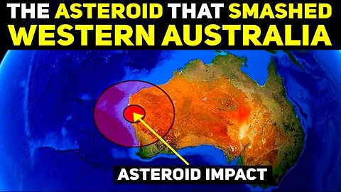
The Massive Asteroid Impact in Western Australia That Shook The World
#westernaustralia #geology #asteroid #asteroidimpact #crater #impactcrater #woodleigh #woodleighcrater #woodleighimpactcrater #australia #geoscience #disaster #earthscience #volcanoes #extinction #extinctionevent #devonian #devonianextinction #comet #meteorite #bolide #asteroids
The Woodleigh Crater is a tremendously large impact crater that's linked to the Devonian extinction crisis. In this video, we head back 360 millions years in time, and analyze one of the worst extinction events to have occurred, and what the Woodleigh impact did to possibly set off the chain of events that would eventually lead to this mass die off of flora and fauna.
I hope you enjoyed this video. If you wish to be in the loop for more content such as this, each like, share, comment and subscription helps the channel out immensely.
If you are not in a position to donate, I totally understand! The biggest supporting factor that you engage in is to watch our videos all the way to the end (very important for helping us rank) and to share them around so please consider doing this so that Youtube recommends our channel more.
If you are in a position to support our channel on Youtube Membership, Patreon, or by donating to our PayPal, the link to all of this can be found below:
If you are not in a position to donate, I totally understand! The biggest supporting factor that you engage in is to watch our videos all the way to the end (very important for helping us rank) and to share them around so please consider doing this so that Youtube recommends our channel more.
If you are in a position to support our channel by donating to our PayPal, or to our Gofundme, the link to all of this can be found below:
Lake Acraman Impact Event:
https://www.youtube.com/watch?v=YYhUiHGpezk
💗 Gofundme
https://www.gofundme.com/f/zkt74-help-ozgeographics-to-fulfill-his-dream
💟 Link to our PayPal:
paypal.me/OzGeographicsYoutube
For one time donations to show your support for this channel and to allow me to focus on this channel.
🌋 Subscribe to our Youtube Channel: https://www.youtube.com/channel/UCxLrvjGBzYmj8W1rJToPasgsub_confirmation=1
🌏 About OzGeographics
OzGeographics, formally known as Geographics, is an Australian based Youtube channel that releases high quality documentaries in an easy to digest format. We primarily release videos that cover topics in the realm of Earth Sciences or natural disasters, but we also release the odd video here or there that delves into other sciences, or other topics altogether depending on how compelling we find the topic at hand.
Our videos are catered for anyone and everyone, and our goal is to attempt to explain hard to understand events in an easy to digest manner that isn't too "dry" in its presentation.
54
views
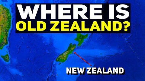
There’s New Zealand… But Where Is Old Zealand?
#newzealand #zeeland #geography #maps #cartography #zealandia #exploration #australia #dutch #netherlands #abeltasman #tasman #holland #maori #newzealanddiscovery #belgium #captainjamescook #britain #english
New Zealand has an interesting origin story. It was originally called Staten Landt, after the dutch explorer, Abel Tasman, confused the South Island for a place that goes by that name in Argentina. Little did he know, he was far, far away from the shores of South America. Instead, he was the first European to set eyes on the beautiful country of New Zealand.
In this video, we're going to answer where Old Zealand actually is. And the answer? Well... it's very, very far from New Zealand.
I hope you enjoyed this video. If you wish to be in the loop for more content such as this, each like, share, comment and subscription helps the channel out immensely.
If you are not in a position to donate, I totally understand! The biggest supporting factor that you engage in is to watch our videos all the way to the end (very important for helping us rank) and to share them around so please consider doing this so that Youtube recommends our channel more.
If you are in a position to support our channel by donating to our PayPal, or to our Gofundme, the link to all of this can be found below:
💗 Gofundme
https://www.gofundme.com/f/zkt74-help-ozgeographics-to-fulfill-his-dream
💟 Link to our PayPal:
paypal.me/OzGeographicsYoutube
For one time donations to show your support for this channel and to allow me to focus on this channel.
🌋 Subscribe to our Youtube Channel: https://www.youtube.com/channel/UCxLrvjGBzYmj8W1rJToPasgsub_confirmation=1
🌏 About OzGeographics
OzGeographics, formally known as Geographics, is an Australian based Youtube channel that releases high quality documentaries in an easy to digest format. We primarily release videos that cover topics in the realm of Earth Sciences or natural disasters, but we also release the odd video here or there that delves into other sciences, or other topics altogether depending on how compelling we find the topic at hand.
Our videos are catered for anyone and everyone, and our goal is to attempt to explain hard to understand events in an easy to digest manner that isn't too "dry" in its presentation.
193
views
5
comments
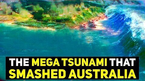
The Mega Tsunami That Smashed South East Australia & Drowned Victoria & Tasmania
5000 years ago, a comet broke apart into three pieces upon entry into Earth. The largest piece, smashed into the indian ocean, with the other two smaller pieces landing in different areas of the Pacific Ocean. The Indian Ocean impact, was incredibly disastrous. It landed in a very deep part of the ocean, and, as a result, it released a truly monstrous mega tsunami during impact. This tsunami was so disastrous, that 600 foot high mountains were built in Madagascar in the blink of an eye, when massive amount of churned up sediment that was carried by it, got deposited in truly vast quantities here, and everywhere else that this tsunami stuck, too, including very, very far places, such as Tasmania.
When this Mega tsunami struck, it did so with such force, that it severely eroded entire cliff faces, and left deep gashing scars in the land, which document the direction the flow. Along with this, it also deposited something known as seismic chevrons. Which are arrow shaped hills of deposition, that were left after the wave had slammed into Australia. When it began to recede, all the material it carried was just dropped where it landed, and the water move out, but the sediment remained. Because of this, massive layers of sand were deposited, and even though 5000 years have passed, you can still see many places where this tsunami impacted.
In this video we take a look at how this massive tidal wave acted when it struck the land of Tasmania, Victoria, and the islands inbetween. Some severe erosive damage was etched into the bedrock of a large section of land from the south western most tip of Tasmania, all the way up to and past Warrnambool in Victoria. In Tasmania, large cliff faces bare the marks of this event in the form of giant east to west orientated scratches, that clearly shows the massive erosive force this mega tsunami unleashed upon the land, altering it in an instant forever.
This is episode two of a large series I have planned that covers the mega tsunami chevron deposition left over following the mega tsunami. And I intend on travelling to all the affected continents to note the damage, and to cover the massive deluge that occurred later on, which is dated to have coincided with the onset of the biblical flood stories which are documented by over 150 different cultures worldwide.
I hope you enjoyed this video. If you wish to be in the loop for more content such as this, each like, share, comment and subscription helps the channel out immensely.
Link to Part 1 of this series:
https://www.youtube.com/watch?v=V_H6W2R88Z0
If you are not in a position to donate, I totally understand! The biggest supporting factor that you engage in is to watch our videos all the way to the end (very important for helping us rank) and to share them around so please consider doing this so that Youtube recommends our channel more.
If you are in a position to support our channel on Youtube Membership, Patreon, or by donating to our PayPal, the link to all of this can be found below:
Link to studies:
https://academiccommons.columbia.edu/doi/10.7916/D89P31F3
https://ui.adsabs.harvard.edu/abs/2010avh..confE..13A/abstract
💗 SUPPORT OUR PATREON
https://www.patreon.com/OzGeographics
Become a Patreon to unlock special perks, benefits, and the link to our discord server.
🎥 Join our Youtube Channel!
https://www.youtube.com/channel/UCxLrvjGBzYmj8W1rJToPasg/join
Become a Member to access special perks, benefits, our discord server and badges!
💟 Link to our PayPal:
paypal.me/OzGeographicsYoutube
For one time donations to show your support for this channel and to allow me to focus on this channel.
🌋 Subscribe to our Youtube Channel: https://www.youtube.com/channel/UCxLrvjGBzYmj8W1rJToPasgsub_confirmation=1
🌏 About OzGeographics
OzGeographics, formally known as Geographics, is an Australian based Youtube channel that releases high quality documentaries in an easy to digest format. We primarily release videos that cover topics in the realm of Earth Sciences or natural disasters, but we also release the odd video here or there that delves into other sciences, or other topics altogether depending on how compelling we find the topic at hand.
Our videos are catered for anyone and everyone, and our goal is to attempt to explain hard to understand events in an easy to digest manner that isn't too "dry" in its presentation.
1.16K
views
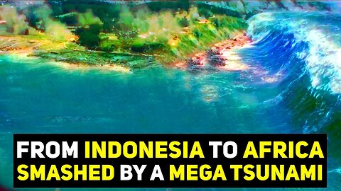
The Mega Tsunami That Smashed Indonesia, India, The Middle East & Africa
#megatsunami #tsunami #tidalwave #hugewaves #flooding #comet #impact #event #burcklecrater #crater #australia #indonesia #antarctica #india #srilanka #pakistan #oman #yemen #somalia #madagascar #southafrica #africa #asia #indoasia #middleeast #gulfof #geoscience #geology #naturaldisaster #naturaldisasters #meteorite #asteroid #asteroidhittingearth #meteoritecrater #meteorites #earthscience #geological #supervolcano #gawlerranges #earthsciences #volcanoes #geosciences
5000 years ago, a comet broke apart into three pieces upon entry into Earth. The largest piece, smashed into the indian ocean, with the other two smaller pieces landing in different areas of the Pacific Ocean. The Indian Ocean impact, was incredibly disastrous. It landed in a very deep part of the ocean, and, as a result, it released a truly monstrous mega tsunami during impact. This tsunami was so disastrous, that 600 foot high mountains were built in Madagascar in the blink of an eye, when massive amount of churned up sediment that was carried by it, got deposited in truly vast quantities here, and everywhere else that this tsunami stuck, too, including very, very far places, such as Tasmania.
When this Mega tsunami struck, it did so with such force, that it severely eroded entire cliff faces, and left deep gashing scars in the land, which document the direction the flow. Along with this, it also deposited something known as seismic chevrons. Which are arrow shaped hills of deposition, that were left after the wave had slammed into every coastline around the Indian ocean. When it began to recede, all the material it carried was just dropped where it landed, and the water move out, but the sediment remained. Because of this, massive layers of sand were deposited, and even though 5000 years have passed, you can still see many places where this tsunami impacted.
In this video we take a look at how this massive tidal wave acted when it struck every coastline, beginning with Indonesia, and working our way to Sri Lanka, India, Pakistan, Oman, Yemen, Somalia, Madagascar, and then finally concluding in South Africa.
This is the final episode of the large series that covers the mega tsunami chevron deposition left over following the mega tsunami. And I intend on travelling to all the affected continents to note the damage, and to cover the massive deluge that occurred later on, which is dated to have coincided with the onset of the biblical flood stories which are documented by over 150 different cultures worldwide.
I hope you enjoyed this video. If you wish to be in the loop for more content such as this, each like, share, comment and subscription helps the channel out immensely.
If you are not in a position to donate, I totally understand! The biggest supporting factor that you engage in is to watch our videos all the way to the end (very important for helping us rank) and to share them around so please consider doing this so that Youtube recommends our channel more.
If you are in a position to support our channel by donating to our PayPal, or our gofundme, the link to all of this can be found below:
Link to studies:
https://academiccommons.columbia.edu/doi/10.7916/D89P31F3
https://ui.adsabs.harvard.edu/abs/2010avh..confE..13A/abstract
💗 Gofundme
https://www.gofundme.com/f/zkt74-help-ozgeographics-to-fulfill-his-dream
💟 Link to our PayPal:
paypal.me/OzGeographicsYoutube
For one time donations to show your support for this channel and to allow me to focus on this channel.
🌋 Subscribe to our Youtube Channel: https://www.youtube.com/channel/UCxLrvjGBzYmj8W1rJToPasgsub_confirmation=1
Link to episodes in this Mega Tsunami Series:
Episode 1: https://www.youtube.com/watch?v=V_H6W2R88Z0
Episode 2: https://www.youtube.com/watch?v=syCWb_ySJRo
Episode 3: https://www.youtube.com/watch?v=DBBCKghodVI
Episode 4: https://www.youtube.com/watch?v=V_H6W2R88Z0
Episode 5: https://www.youtube.com/watch?v=tasGHdFXa0s
🌏 About OzGeographics
OzGeographics, formally known as Geographics, is an Australian based Youtube channel that releases high quality documentaries in an easy to digest format. We primarily release videos that cover topics in the realm of Earth Sciences or natural disasters, but we also release the odd video here or there that delves into other sciences, or other topics altogether depending on how compelling we find the topic at hand.
Our videos are catered for anyone and everyone, and our goal is to attempt to explain hard to understand events in an easy to digest manner that isn't too "dry" in its presentation.
279
views
2
comments
The Burckle Crater Mega Tsunami & Global Flood (THE FULL DOCUMENTARY)
#megatsunami #tsunami #tidalwave #hugewaves #flooding #comet #impact #event #burcklecrater #crater #australia #indonesia #antarctica #india #srilanka #pakistan #oman #yemen #somalia #madagascar #southafrica #africa #asia #indoasia #middleeast #gulfof #geoscience #geology #naturaldisaster #naturaldisasters #meteorite #asteroid #asteroidhittingearth #meteoritecrater #meteorites #earthscience #geological #supervolcano #gawlerranges #earthsciences #volcanoes #geosciences
5000 years ago, a comet broke apart into three pieces upon entry into Earth. The largest piece, smashed into the indian ocean, with the other two smaller pieces landing in different areas of the Pacific Ocean. The Indian Ocean impact, was incredibly disastrous. It landed in a very deep part of the ocean, and, as a result, it released a truly monstrous mega tsunami during impact. This tsunami was so disastrous, that 600 foot high mountains were built in Madagascar in the blink of an eye, when massive amount of churned up sediment that was carried by it, got deposited in truly vast quantities here, and everywhere else that this tsunami stuck, too, including very, very far places, such as Tasmania.
When this Mega tsunami struck, it did so with such force, that it severely eroded entire cliff faces, and left deep gashing scars in the land, which document the direction the flow. Along with this, it also deposited something known as seismic chevrons. Which are arrow shaped hills of deposition, that were left after the wave had slammed into every coastline around the Indian ocean. When it began to recede, all the material it carried was just dropped where it landed, and the water move out, but the sediment remained. Because of this, massive layers of sand were deposited, and even though 5000 years have passed, you can still see many places where this tsunami impacted.
This the full documentary, that combines every episode of the Burckle Crater Mega Tsunami Series. Including the additional 2 episodes where we went to South America and New Zealand, and the two episodes that cover the deluge event, and a possible explanation for the mesopotamian versions that explained this event / that we written about in biblical texts. We endeavor to offer a sound scientific explanation for these stories, and for the event that happened to support researchers in their investigations, whilst also raising awareness to anyone who is interested in these types of major, world changing events.
I hope you enjoyed this video. If you wish to be in the loop for more content such as this, each like, share, comment and subscription helps the channel out immensely.
If you are not in a position to donate, I totally understand! The biggest supporting factor that you engage in is to watch our videos all the way to the end (very important for helping us rank) and to share them around so please consider doing this so that Youtube recommends our channel more.
If you are in a position to support our channel by donating to our PayPal, or our gofundme, the link to all of this can be found below:
Link to studies:
https://academiccommons.columbia.edu/doi/10.7916/D89P31F3
https://ui.adsabs.harvard.edu/abs/2010avh..confE..13A/abstract
💗 Gofundme
https://www.gofundme.com/f/zkt74-help-ozgeographics-to-fulfill-his-dream
💟 Link to our PayPal:
paypal.me/OzGeographicsYoutube
For one time donations to show your support for this channel and to allow me to focus on this channel.
🌋 Subscribe to our Youtube Channel: https://www.youtube.com/channel/UCxLrvjGBzYmj8W1rJToPasgsub_confirmation=1
Link to episodes in this Mega Tsunami Series:
Episode 1: https://www.youtube.com/watch?v=V_H6W2R88Z0
Episode 2: https://www.youtube.com/watch?v=syCWb_ySJRo
Episode 3: https://www.youtube.com/watch?v=DBBCKghodVI
Episode 4: https://www.youtube.com/watch?v=V_H6W2R88Z0
Episode 5: https://www.youtube.com/watch?v=tasGHdFXa0s
Episode 6: https://www.youtube.com/watch?v=7w6HrPujyJQ
Episode 7: https://www.youtube.com/watch?v=_GzJfnWllGE
Episode 8: https://www.youtube.com/watch?v=Fri-lXx01x4
Global Deluge:
Episode 9: https://www.youtube.com/watch?v=CGFPOp61t3A
Episode 10: https://www.youtube.com/watch?v=3LeOues4Kp4
🌏 About OzGeographics
OzGeographics, formally known as Geographics, is an Australian based Youtube channel that releases high quality documentaries in an easy to digest format. We primarily release videos that cover topics in the realm of Earth Sciences or natural disasters, but we also release the odd video here or there that delves into other sciences, or other topics altogether depending on how compelling we find the topic at hand.
Our videos are catered for anyone and everyone, and our goal is to attempt to explain hard to understand events in an easy to digest manner that isn't too "dry" in its presentation.
327
views
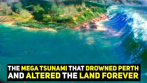
The Mega Tsunami that Smashed Western Australia & Drowned Perth
5000 years ago, a comet broke apart into three pieces upon entry into Earth. The largest piece, smashed into the indian ocean, with the other two smaller pieces landing in different areas of the Pacific Ocean. The Indian Ocean impact, was incredibly disastrous. It landed in a very deep part of the ocean, and, as a result, it released a truly monstrous mega tsunami during impact. This tsunami was so disastrous, that 600 foot high mountains were built in Madagascar in the blink of an eye, when massive amount of churned up sediment that was carried by it, got deposited in truly vast quantities here, and everywhere else that this tsunami stuck, too, including very, very far places, such as Tasmania.
When this Mega tsunami struck, it did so with such force, that it severely eroded entire cliff faces, and left deep gashing scars in the land, which document the direction the flow. Along with this, it also deposited something known as seismic chevrons. Which are arrow shaped hills of deposition, that were left after the wave had slammed into Australia. When it began to recede, all the material it carried was just dropped where it landed, and the water move out, but the sediment remained. Because of this, massive layers of sand were deposited, and even though 5000 years have passed, you can still see many places where this tsunami impacted.
The entire western coast of Western Australia, and the southern coast of it, had towns that are built ontop of the sediment released by the mega tsunami, as this entire section of land was deeply affected by the 180 odd meter waves that struck here with savage force. Stretching inland as far as 30km in some places, and even further in others.
In this video we take a look at how this massive tidal wave acted when it struck the land where the present day capital city of Western Australia, Perth, is built. Unfortunately, it's not good news. If this happened today... well... You know where I'm going with this.
This is episode one of a large series I have planned that covers the mega tsunami chevron deposition left over following the mega tsunami. And I intend on travelling to all the affected continents to note the damage, and to cover the massive deluge that occurred later on, which is dated to have coincided with the onset of the biblical flood stories which are documented by over 150 different cultures worldwide.
I hope you enjoyed this video. If you wish to be in the loop for more content such as this, each like, share, comment and subscription helps the channel out immensely.
If you are not in a position to donate, I totally understand! The biggest supporting factor that you engage in is to watch our videos all the way to the end (very important for helping us rank) and to share them around so please consider doing this so that Youtube recommends our channel more.
If you are in a position to support our channel on Youtube Membership, Patreon, or by donating to our PayPal, the link to all of this can be found below:
Link to studies:
https://academiccommons.columbia.edu/doi/10.7916/D89P31F3
https://ui.adsabs.harvard.edu/abs/2010avh..confE..13A/abstract
💗 SUPPORT OUR PATREON
https://www.patreon.com/OzGeographics
Become a Patreon to unlock special perks, benefits, and the link to our discord server.
🎥 Join our Youtube Channel!
https://www.youtube.com/channel/UCxLrvjGBzYmj8W1rJToPasg/join
Become a Member to access special perks, benefits, our discord server and badges!
💟 Link to our PayPal:
paypal.me/OzGeographicsYoutube
For one time donations to show your support for this channel and to allow me to focus on this channel.
🌋 Subscribe to our Youtube Channel: https://www.youtube.com/channel/UCxLrvjGBzYmj8W1rJToPasgsub_confirmation=1
🌏 About OzGeographics
OzGeographics, formally known as Geographics, is an Australian based Youtube channel that releases high quality documentaries in an easy to digest format. We primarily release videos that cover topics in the realm of Earth Sciences or natural disasters, but we also release the odd video here or there that delves into other sciences, or other topics altogether depending on how compelling we find the topic at hand.
Our videos are catered for anyone and everyone, and our goal is to attempt to explain hard to understand events in an easy to digest manner that isn't too "dry" in its presentation.
#megatsunami #tsunami #tidalwave #hugewaves #flooding #comet #impact #event #burcklecrater #crater #australia #perth #westaustralia #westernaustralia #tasmania #victoria #melbourne #southaustralia #adelaide #geoscience #geology #naturaldisaster #naturaldisasters #meteorite #asteroid #asteroidhittingearth #meteoritecrater #meteorites #earthscience #geological #supervolcano #gawlerranges #earthsciences #volcanoes #geosciences
1.7K
views
7
comments