


How to design cut and fill #profile for road design on #autocad #civil3d #road #civilengineering
Follow my videos by Subscribing to the channel
````````````````````````````````````````````````````````````````````````````````````````````````
#cut and #fill extraction, sometimes called “#excavation and #embankment,” means moving earth from one location to another to reach a particular surface or #volume. #construction teams use cut and fill #maps generated from #topographical #surveys, often performed by drones, to see where they need to add or remove #material
#python project #anaconda spyder #Geomatics #Engineering #coders #GIS #Autocad #QGIS #EngineeringConcepts
4
views

Set up Qfield cloud for many team members #qfield #qfieldcloud #qgis #gis #surveying #data #mapping
Follow my videos by Subscribing to the channel
This video shows you how to set up QFIELD project for your team members to map to one QGIS project.
Find the links for setting up on android and iOS below;
---------------Set up on Android Phone--------------------
https://youtu.be/Hf2DNveGfJk
--------------------Set up on iOS Phone --------------------
https://youtu.be/yIuLe18tQvU
#python project #anaconda spyder #Geomatics #Engineering #coders #GIS #Autocad #QGIS #EngineeringConcepts
15
views

QField Cloud for #android. Connect your QGIS project to your phone for data collection #qfield #gis
Follow my videos by Subscribing to the channel
Create, edit, visualise, analyse and publish geospatial information. For Windows, Mac, Linux, BSD and Android.
#QFieldCloud allows to synchronize and merge the #data collected by your team in QField. From small individual #projects to large #data #collection campaigns, QFieldCloud removes the pain from #synchronizing and merging data.
#python project #anaconda spyder #Geomatics #Engineering #coders #GIS #Autocad #QGIS #EngineeringConcepts
7
views

QField Cloud for iOS device. Connect your QGIS project to iOS phone for data collection #qfield #gis
Follow my videos by Subscribing to the channel
Create, edit, visualise, analyse and publish geospatial information. For Windows, Mac, Linux, BSD and Android.
#QFieldCloud allows to synchronize and merge the #data collected by your team in QField. From small individual #projects to large #data #collection campaigns, QFieldCloud removes the pain from #synchronizing and merging data.
#python project #anaconda spyder #Geomatics #Engineering #coders #GIS #Autocad #QGIS #EngineeringConcepts
11
views
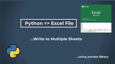
How to write \Export to multiple sheets in Excel using Python #python #excel #sheets #datascience
Follow my videos by Subscribing to the channel
To write to multiple sheets it is necessary to create an ExcelWriter object with a target file name and specify a sheet in the file to write to. Multiple sheets may be written by specifying a unique sheet_name.
#python project #anaconda spyder #Geomatics #Engineering #coders #GIS #Autocad #QGIS #EngineeringConcepts
21
views
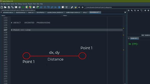
How I explain Object Oriented Programming to absolute beginners WITH ILLUSTRATION | #oop #python
Follow my videos by Subscribing to the channel
#python project #anaconda spyder #Geomatics #Engineering #coders #GIS #Autocad #QGIS #EngineeringConcepts
5
views
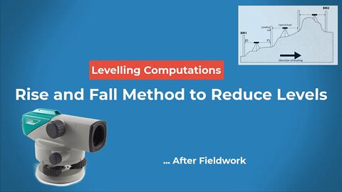
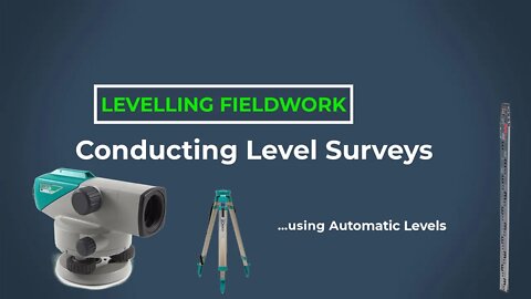
Level Survey Part 5: Rise and Fall method of reducing Level Data into Elevations/Spotheights
SUBSCRIBE FOR MORE VIDEOS LIKE THIS
#python project #anaconda spyder #Geomatics #Engineering #coders #GIS #Autocad #QGIS #EngineeringConcepts
Level Survey Part 4: How to conduct a level survey - from benchmark 1-2 #engineering #survey
SUBSCRIBE FOR MORE VIDEOS LIKE THIS
#python project #anaconda spyder #Geomatics #Engineering #coders #GIS #Autocad #QGIS #EngineeringConcepts
1
view
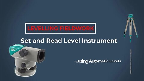
Level Survey Part 3: How to set up and read Automatic Level on site #engineering #survey #site
SUBSCRIBE FOR MORE VIDEOS LIKE THIS
#python project #anaconda spyder #Geomatics #Engineering #coders #GIS #Autocad #QGIS #EngineeringConcepts
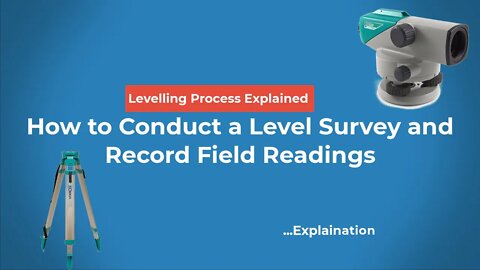
Level Survey Part 2: How to Conduct a Level Survey and Record Field Readings #engineering #survey
SUBSCRIBE FOR MORE VIDEOS LIKE THIS
#python project #anaconda spyder #Geomatics #Engineering #coders #GIS #Autocad #QGIS #EngineeringConcepts
1
view
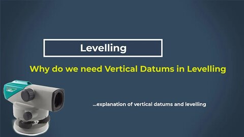
Level Survey PART 1: Why we need DATUMS for level surveys #survey #landsurveying #engineering
SUBSCRIBE FOR MORE VIDEOS LIKE THIS
#python project #anaconda spyder #Geomatics #Engineering #coders #GIS #Autocad #QGIS #EngineeringConcepts
2
views
How to make proposed design for Cut and Fill Profiles on Autocad Civil 3D #autocad #design #civil3d
SUBSCRIBE FOR MORE VIDEOS LIKE THIS
#python project #anaconda spyder #Geomatics #Engineering #coders #GIS #Autocad #QGIS #EngineeringConcepts
10
views

File handling on python| Create, Open, Read, Write files using python #python #filehandling #coders
SUBSCRIBE FOR MORE VIDEOS LIKE THIS
#python project #anaconda spyder #Geomatics #Engineering #coders #GIS #Autocad #QGIS #engineeringconcepts
Python too supports file handling and allows users to handle files i.e., to read and write files, along with many other file handling options, to operate on files.
Four ways of handling files;
"r" - Read - Default value. Opens a file for reading, error if the file does not exist
"a" - Append - Opens a file for appending, creates the file if it does not exist
"w" - Write - Opens a file for writing, creates the file if it does not exist
"x" - Create - Creates the specified file, returns an error if the file exists
6
views
Simple way to create locator / Inset Map on QGIS for your research site #qgis #locatormap #inset
SUBSCRIBE FOR MORE VIDEOS LIKE THIS
#python project #anaconda spyder #Geomatics #Engineering #coders #GIS #Autocad #QGIS #EngineeringConcepts
5
views
Python with PostGres SQL Database - Read and Write data to a relational Database #python #postgres
SUBSCRIBE FOR MORE VIDEOS LIKE THIS
#python project #anaconda spyder #Geomatics #Engineering #coders #GIS #Autocad #QGIS #EngineeringConcepts
10
views
Create Quick layouts for your maps in QGIS and export them into pdf, jpeg for printing #gis #qgis
SUBSCRIBE FOR MORE VIDEOS LIKE THIS
#python project #anaconda spyder #Geomatics #Engineering #coders #GIS #Autocad #QGIS #EngineeringConcepts
10
views
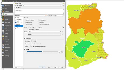
QGIS Map Labels: How to correctly label your map using Single &Rule-based Styles in GIS #qgis #gis
SUBSCRIBE FOR MORE VIDEOS LIKE THIS
#python project #anaconda spyder #Geomatics #Engineering #coders #GIS #Autocad #QGIS #EngineeringConcepts
8
views
Use Rule Based Styling method to make your maps beautiful on QGIS #qgis #gis
SUBSCRIBE FOR MORE VIDEOS LIKE THIS
#python project #anaconda spyder #Geomatics #Engineering #coders #GIS #Autocad #QGIS #EngineeringConcepts
Styling your maps is an important part of catography, there are several ways of styling your maps.
1. Single Symbol
2. Rule-Based Styling
3. Categorized styling
4. Graduated Styling etc.
This video shows you how to use SQL-based rules to style specific parts of your maps.
10
views
How to style your maps on QGIS using: Single rule, Categorize and Graduated styling methods #qgis
SUBSCRIBE FOR MORE VIDEOS LIKE THIS
#python project #anaconda spyder #Geomatics #Engineering #coders #GIS #Autocad #QGIS #EngineeringConcepts
How to style your maps on QGIS using: Single rule, Categorize and Graduated styling methods #qgis
22
views

The need to understand Coordinate Reference System /CRS as a GIS Student #crs #coordinate #gis #qgis
SUBSCRIBE FOR MORE VIDEOS LIKE THIS
#python project #anaconda spyder #Geomatics #Engineering #coders #GIS #Autocad #QGIS #EngineeringConcepts
The need to understand Coordinate Reference System /CRS as a GIS Student #crs #coordinate #gis #qgis
14
views
Exploring data on shapefiles using attribute table. #qgis #gis #attribute #table #shapefile #data
SUBSCRIBE FOR MORE VIDEOS LIKE THIS
#python project #anaconda spyder #Geomatics #Engineering #coders #GIS #Autocad #QGIS #EngineeringConcepts
Exploring data on shapefiles using attribute table. #qgis #gis #attribute #table #shapefile #data
4
views
How to add/import data to your QGIS Project #gis #qgis #data #shapefile #csv
SUBSCRIBE FOR MORE VIDEOS LIKE THIS
#python project #anaconda spyder #Geomatics #Engineering #coders #GIS #Autocad #QGIS #EngineeringConcepts
5
views
Where and How to Download FREE shapefiles, KML data for your GIS Project #shapefiles #gis #qgis
SUBSCRIBE FOR MORE VIDEOS LIKE THIS
#python project #anaconda spyder #Geomatics #Engineering #coders #GIS #Autocad #QGIS #EngineeringConcepts @Pro Geomatics
In this video, I am going to show you where you can download shapefiles and other forms of data (vector/raster) for your GIS projects.
The following links were visited, feel free to explore them.
KINDLY LEAVE A LIKE ON THIS VIDEO AND SUBSCRIBE TO FOLLOW MY VIDEOS
Diva-GIS
https://www.diva-gis.org/gdata
Geofabrik
https://www.geofabrik.de/data/shapefiles.html
Export OSM
https://export.hotosm.org/en/v3/
Statsilk
https://www.statsilk.com/maps/download-free-shapefile-maps
MapCruzin
https://mapcruzin.com/free-world-country-arcgis-maps-shapefiles.htm
31
views

A Quick introduction to the QGIS Environment and How to use it. #qgis #gis
SUBSCRIBE FOR MORE VIDEOS LIKE THIS
#python project #anaconda spyder #Geomatics #Engineering #coders #GIS #Autocad #QGIS #EngineeringConcepts
15
views